Contents
1 Prehistory
2 Ancient history
2.1.1 Ebla civilization
2.1.2 Mari Kingdom
2.2 Roman Syria
1_Prehistory
Since approximately 10, 000 BC Syria was one of the centers of Neolithic culture (PPNA*1), where agriculture and cattle breeding appeared for the first time in the world. The following Neolithic period (PPNB*2) is represented by rectangular houses of the Mureybet culture. At the time of the pre-pottery Neolithic people used vessels made of stone, gypsum and burnt lime (Vaiselles blanches). Finds of obsidian tools from Anatolia are considered evidence of early trade relations.
Cities such as Hamoukar and Emar played an important role during the late Neolithic and Bronze Age.
 |
Female Figurine Syria 5000 BCE
|
Archaeologists
have demonstrated that civilization in Syria was one of the most ancient on earth. Around the excavated city of Ebla
in northern Syria, an Italian mission led by Prof. Paolo Matthiae
discovered evidence in 1975 of a great Semitic empire, spreading from the Red Sea
north to Turkey
and east to Mesopotamia
and thriving from 2500 to 2400 BCE.
 |
| City of Ebla |
Ebla appears to have been founded around 3000 BCE and gradually built its empire through trade with the cities of Sumer and Akkad, as well as with peoples to the northwest. Pharaonic gifts found during excavations confirm Ebla's contact with Egypt. Scholars believe the language of Ebla to be among the oldest known written Semitic languages. The Eblaite civilization was likely conquered by Sargon of Akkad around 2260 BCE; the city was restored as the nation of the Amorites a few centuries later and flourished through the early second millennium BCE until conquered by the Hittites.
 |
| Ebla Caravan Trading directions |
During the second millennium BCE, Syria was occupied successively by Canaanites, Phoenicians, and Arameans as part of the general disruptions associated with the Sea Peoples; the Phoenicians settled along the coastline of these area as well as in the west (Now Lebanon & The current Syrian coast), in the area already known for its cedars. Egyptians, Sumerians, Assyrians, Babylonians, and Hittites variously occupied the strategic ground of Syria during this period, as it was a marchland between their various empires.
 |
| phoenician-temple-at-hibbaryeh-near-banias_Syria |
2_Ancient history
2.1.1 Ebla civilization
The name "Ebla" means "White Rock", and refers to the limestone outcrop on which the city was built. Although the site shows signs of continuous occupation from before 3000 BC, its power grew and reached its apogee in the second half of the following millennium. Ebla's first apogee was between ca. 2400 and 2240 BC;
 |
| Clay tablets " Ebla " |
its name is mentioned in texts from Akkad from ca. 2300 BC. Most of the Ebla palace tablets, which date from that period, are about economic matters; they provide a good look into the everyday life of the inhabitants,as well as many important insights into the cultural, economic, and political life in northern Mesopotamia around the middle of the third millennium B.C. The texts are accounts of the state revenues, but they also include royal letters, Sumerian-Eblaite dictionaries, school texts and diplomatic documents, like treaties between Ebla and other towns of the region.
Ebla's most powerful king of this period was listed as Ebrium, or Ibrium, who concluded the so-called "Treaty with Ashur", which offered the Assyrian king Tudiya the use of a trading post officially controlled by Ebla
The fifth and last king of Ebla during this period was Ebrium's son, Ibbi-Zikir, the first to succeed in a dynastic line, thus breaking with the established Eblaite custom of electing its ruler for a fixed term of office, lasting seven years. This absolutism may have contributed to the unrest that was ultimately instrumental in the cities decline. Meanwhile, the reign of Ibbi-Zikir was considered a time of inordinate prosperity, in part because the king was given to frequent travel abroad. It was recorded both in Ebla and Aleppo that he concluded specific treaties with neighboring Armi, as Aleppo was called at the time
 |
| Ebla |
 |
| Ebla ( Tell Mardikh), By Paolo Matthiae
|
 |
City Ebla
|
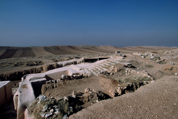
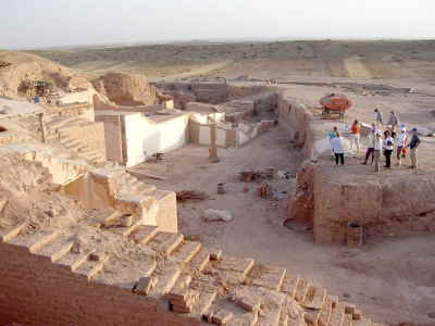
2.1.2 Mari Kingdom
Mari (modern Tell Hariri, Syria) was an ancient Sumerian and Amorite city, located 11 kilometers north-west of the modern town of Abu Kamal on the western bank of Euphrates river
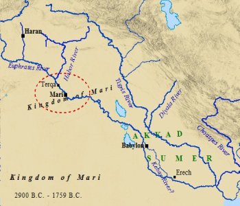 |
| Kingdom of Mari location |
, some 120 km southeast of Deir ez-Zor, Syria. It is thought to have been inhabited since the 5th millennium BC, although it flourished with series of superimposed palaces that spans a thousand years, from 2900 BC until 1759 BC, when it was sacked by Hammurabi.
 |
The ancient city of Mari
|
Mari was discovered in 1933, on the eastern flank of Syria, near the Iraqi border. A Bedouin tribe was digging through a mound for a gravestone that would be used for a recently deceased tribesman, when they came across a headless statue. After the news reached the French authorities currently in control of Syria, the report was investigated, and digging on the site was started on December 14, 1933 by archaeologists from the Louvre in Paris. Discoveries came quickly, with the temple of Ishtar being discovered in the next month. Mari was classified by the archaeologists as the "most westerly outpost of Sumerian culture".[citation needed] Since the beginning of excavations, over 25,000 clay tablets in Akkadian language written in cuneiform were discovered. Finds from the excavation are on display in the National Museum of Aleppo, the National Museum of Damascus, and the Deir ez-Zor Museum. In the latter, the southern façade of the "Court of the Palms" of Zimri-Lim's palace has been reconstructed, including the wall paintings
 |
Tablet Zimri-lim
|
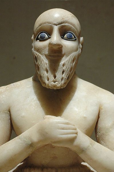 |
| Intendant Ebish-II, found in the temple of Ishtar at Mari
|

 |
| Kingdom of Mari |
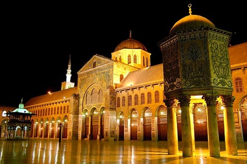
2.2 Roman Syria
Syria was Roman (Byzantine) province from 64 BC to 636 AD.
In the Roman period, the great city of Antioch (called "the Athens of the east" at that time) was the capital of Syria. It was one of the largest cities in the ancient world, with a total estimated population of 500,000, as well as one of the largest centers of trade and industry. As one of the wealthiest and more populous provinces of the Roman Empire, it is estimated that the population of Roman Syria in the early Roman Empire was only exceeded in the mid-20th century, when it may have been as high as 7-8 million or more, if Palestine and Jordan are included, but not including the eastern section of modern day Syria beyond the Euphrates.
 |
| Bosra's superbly preserved Roman amphitheatre
|
In the 3rd century Syria was home to Elagabalus, a Roman emperor of the Severan dynasty who reigned from 218 to 222. Elagabalus' family held hereditary rights to the priesthood of the sun god El-Gabal, of whom Elagabalus was the high priest at Emesa (modern Homs) in Syria.
Syria is significant in the history of Christianity; Paul was converted on the Road to Damascus and emerged as a significant figure in the first organized Christian Church at Antioch in ancient Syria, from which he left on many of his missionary journeys.
 |
| Roman Ruins, Palmyra
|
References :
*1 : Pre-Pottery Neolithic A (PPNA) denotes the first stage in early Levantine Neolithic culture, dating around 9500 to 8500 BC .
*2 : Pre-Pottery Neolithic B (PPNB) is a division of the Neolithic developed by Dame Kathleen Kenyon during her archaeological excavations at Jericho in the southern Levant region.


_Dervish,_Syrian_Peasant,_Young_Druse_Woman,_Karvass_(Police_Officer)_in_Damascus.jpg)